Located in/near Cashiers
These are some of the more popular hikes in our area. Please consult our local newpaper, the The Highlander, for hiking club activities. There are several good hiking guide books available at the Highland Hiker. During the summer months there is a fair amount of poison ivy on many trails so it is always wise to wear long pants and be on the lookout for it.
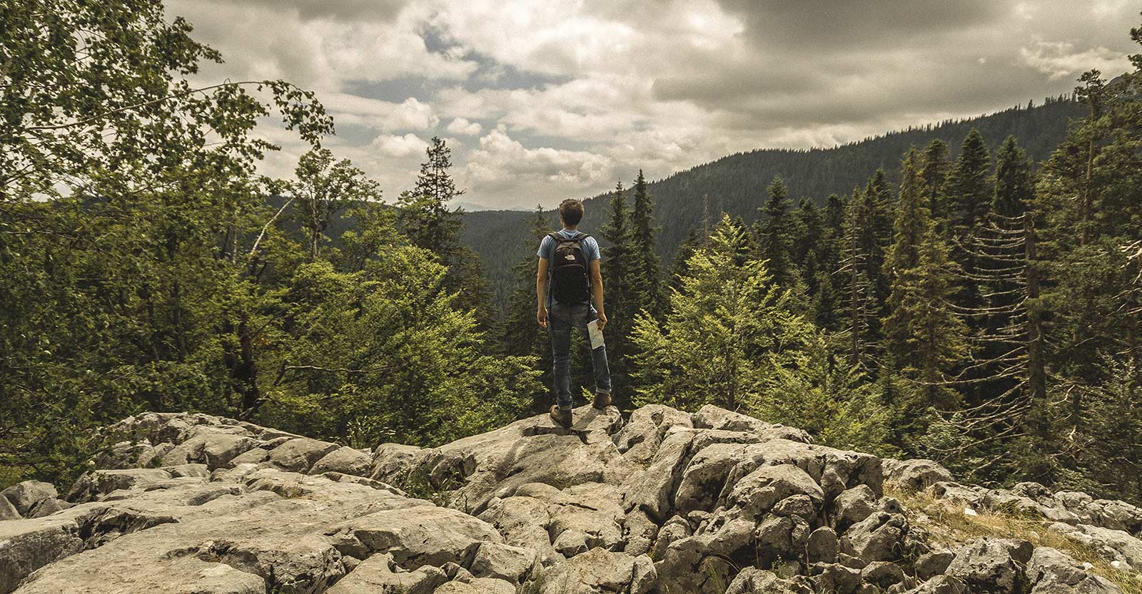
Whiteside Mountain (2 mile loop)
It’s an easy to moderate hike to 4,940-foot elevation along the eastern Continental Divide and along spectacular sheer cliffs, which are the highest in the eastern U.S. From the Crossroads drive west on U.S. 64 in the direction of Highlands for 4.7 miles. Watch for the brown sign “Whiteside Mountain Trail” and turn left onto Whiteside Mountain Road. Continue 1.1 miles passing Wildcat Cliffs Country Club on the right. Turn left into gravel parking lot.
Yellow Mountain
This is a difficult 5 mile trip that takes from 3 to 5+ hours round trip. There are steep ascents and descents to an old stone and wood fire tower at 5,127 ft. elevation. Enjoy beautiful views and a diversity of plant life. From the Crossroads drive west on U.S. 64 towards Highlands. Continue for 7.3 miles and turn right onto Buck Creek Road. Go 2.2 miles passing Chestnut Hill on the right. Look for steep path on right with small wooden sign and steps leading to the trail. Park on the left in the gravel. If you pass Cole Mountain Circle, you’ve gone too far.
Pantertown Valley (Multiple use area)
Hiking and mountain biking are permitted year-round as well as fishing in season. 6,700 acres of high mountain valley, sheer rock, waterfalls, quiet streams and diverse vegetation. Trails, from old logging roads to footpaths criss-cross the area. As NONE of the trails are marked with any signage do not venture in without a map which can be obtained at Highland Hiker in town. Plan to spend at least half a day to enjoy this amazing valley. From the Crossroads drive east on Hwy 64 towards Sapphire Valley for 2 miles. Turn left on to Cedar Creek Road and continue for 2.3 miles and turn right onto Breedlove Road. Continue for 4 miles (last 2/10 mile is very rough) to Valley entrance.
Bad Creek
This is a strenuous 7 mile hike through Ellicott Rock Wilderness Area to a tranquil spot on the Chattooga River. From the Crossroads drive south on Hwy 107 towards South Carolina. Go 7 miles to a right turn onto Bull Pen Road. If you pass the NC/SC state line you’ve gone too far. Continue on Bull Pen Road for 2.7 miles and park on the right in the gravel. Just after the Fowler Creek Bridge. Walk back over and slightly past the bridge and the trailhead is on the opposite side of the road from the parking area.
Iron Bridge
From the Crossroads drive south on Hwy 107 towards South Carolina. Go 7 miles to a right turn onto Bull Pen Road. Travel 3.2 miles until you come to an iron bridge. On the right side of the road is a trail that goes alongside the river for several miles. There are also paths descending to big rocks & it’s ideal for picnics.
Sliding Rock and Picnic Spot
This is a great place for children and picnics. Take Highway 107 South about 1 mile from the intersection in Cashiers to Whiteside Cove Road (SR1107). Turn right and follow the road 2.6 miles where you will find a pull-off area off to the right just past a bridge, there is also another pull-off area a little further up on the right. There are trails leading to the waterfall good for sliding and a little sandy beach. There is also a wading spot and beach further up the stream with a trail leading to it. The rock is extremely slippery and children should exercise caution.
Silver Run Falls
A pristine 25-foot waterfall and wading pool with a small sand beach can be found nestled among towering hemlocks and shady hardwoods. This is another great place for a picnic. Take Highway 107 South about 3.6 miles from the intersection in Cashiers. On the left side of the road there is a pull off area with a path leading to the falls.
Horsepasture River Trail
Take Highway 64 East towards Brevard approximately 10 miles. Turn right on NC 281 and go South for 1.8 miles to the parking area on the left side of the road at the sign for Gorges State Park. Once you park your car you will walk back to the road, turn left and proceed a short distance where you will see the trail entrance on your left. Follow the main trail which is slightly downhill and there are 3 different waterfalls. Drift Falls is close to NC 281 and you will need to turn right and double back from the main trail several hundred yards into the trail to get to it. Continuing on the main trail the second waterfall is Turtleback Falls, often used as a sliding rock by the more adventurous. Continuing further is the majestic Rainbow Falls. CAUTION: DO NOT ENTER THE RIVER BETWEEN TURTLEBACK AND RAINBOW FALLS!! People die here every year when they are pulled over the waterfall from the river above it. This is a 100+ foot waterfall! For a greater fitness opportunity a fourth waterfall is beyond Rainbow Falls, called Stairstep Falls.
Rough Run
This is a great wildflower hike in the spring and a great waterfall hike any time. A fair amount of poison ivy grows near the trail during the summer so it’s best to wear long pants.Starting from the Crossroads head North on Highway 107 for 8.2 miles. Watch for a street sign on the left for Shoal Creek Mountain Road. Take that hard left turn and proceed down the gravel road passing the double gate on the right. Park on the right side of the gravel road. Walk back to the gate wich is the beginning of the trail.Allow two hours+ walking time plus however long you want to linger at the falls with your lunch.
Walhalla National Fish Hatchery
Located just 3.4 miles across the North Carolina/South Carolina border, this hatchery is one of the nation’s largest trout hatcheries. Visitors are welcome to tour the hatchery and fish on the East Fork of the Chattooga River which runs through the hatchery grounds. A picnic area is adjacent to the hatchery and is run by the U.S. Forest Service. Hikers can take a 2.5 mile trail that follows the East Fork of the Chattooga River. For more information and hours of operation please call (864)638-2866.