Located in the Beautiful North Carolina Mountains
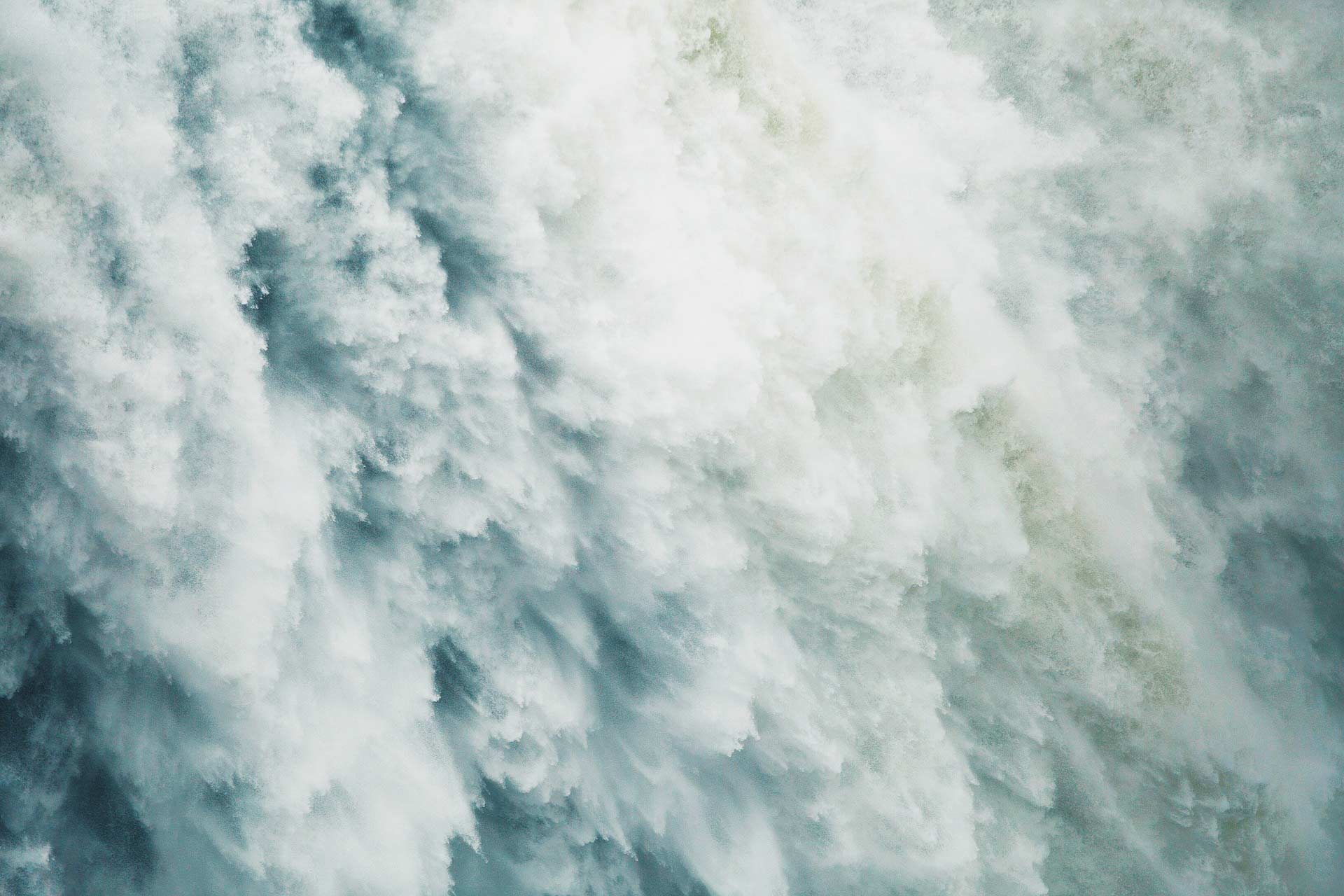
Whitewater Falls
These falls are the tallest falls in the eastern United States. At 411 feet, they are higher than Niagara Falls. Follow Hwy 107 South for 8.5 miles and about 1 mile past the NC?SC border. Turn left onto Hwy 281 and follow thid for 2.2 miles, turning left at that intersection, following the signs to Whitewater Falls. From this point it is approximately 12 miles. Parking for the falls is on the right. You can follow trails that take you above and below the falls, but it is not necessary to take these to view the falls. You can also access these falls by following Hwy 281 just East of Cashiers.
Silver Run Falls
This 40 foot Falls cascades into a beautiful pool that is a great swimming hole in the hot summer months! Follow Hwy 107 South approximately 3 miles from the Crossroads. There is a small, gravel turnout on the left with an idenitfying sign. The short trail takes you across a small raised bridge with the falls ahead on your right.
Cashiers Sliding Rock
Nature’s own waterslide! Perfect for smaller children. Take Hwy 107 South approximately 2 miles turning right on Whiteside Cove Rd, just past the High Hampton Golf Course. Continue over the Whiteside Cove Bridge where there is available parking. A very short trail is visible from the parking area. We suggest that you wear shorts over your bathsuits as it’s a little rough on tender skin!
Rainbow & Turtleback Falls
Located on the Horsepasture River, these falls are located off Hwy 281 South. Park at Gorges State Park and walk out to the hwy, then take the cleared walkway to your left. You’ll see a logging road which will ake you to the waterfalls. This hike is moderately strenuous.
Dry Falls
Take Hwy 64 west towards Franklin for 3.6 miles. The parking for this spectacular falls is on the left and you must use the self service parking envelope or you will be fined for parking without paying. Dry Falls was named because you can walk behind the falls and stay dry. It’s a beautiful and powerful waterfall to enjoy!
Cullasaja Falls
From Dry Falls, continue West on Hwy 64. This spectaular falls is visable from the righthand side of the road. The parking area is very small and you have to drive further west, turning around and going back to it to view the falls. Be very careful as the road is narrow here. Walking down to the base of the falls is discouraged.
Bridal Veil Falls
As you drive towards Dry Falls, you’ll see a lovely waterfall on the right. A long standing landmark, you could drive right under the falls. However in 2002, the top rocks that comprised the falls collapsed blocking the drive through.
Glen Falls
Located on Hwy 106 South towards the Georgia State Line approximately 3 miles from the stoplight at Hwys 64 and 106. Turn left on SR 1618, there is a sign for Glen Falls. The parking area is about 1.1 miles down this road. There is a series of 3 falls. The trail to the bottom set of falls is steep and coming back up is a bit rugged.
Kalakaleskies Falls
Located off Hwy 28/64 West about 3 miles from downtown Highlands. The Sequoia Lake Dam is at the head of these falls and there are 18 small falls within ¼ mile paralleling Hwy 28/64.
Picklesimer Rockhouse Falls
Located approximately 5 miles on Hwy 28. Turn right on SR 1618/FS79 and travel 4.4 miles to an unmarked forest service road on the right. Park on the left side of FS79 in the pulout provided, but do not block the gate. Hike ½ mile down the unmarked logging road. Cross over a small creek, looking for a small path that goes through a thicket and leads upstream. Take this path for 1/10 mile.
Lower Satulah Falls (Cedar Creek Falls)
Located 2 miles south of Highlands, a narrow waterfall is visible from an overlook on the west side of Hwy 28.